برنامج OKM Rover C4 | برنامج تعليمي للمسح الأرضي ثلاثي الأبعاد
استخدام جهاز OKM Rover C4 للمسح الأرضي ثلاثي الأبعاد
في هذا الدرس التفصيلي، يشرح لك مارك هاريس، نائب رئيس OKM Americas، خطوة بخطوة كيفية إجراء مسح أرضي ثلاثي الأبعاد باستخدام جهاز OKM Rover C4. تم تصوير هذا الفيديو في مقر OKM في ألتنبورغ بألمانيا، ويقدم مقدمة عملية رائعة لقدرات جهاز Rover C4، من الإعداد إلى التحليل النهائي. سواء كنت جديدًا في مجال المسح الأرضي أو ترغب في تحسين مهاراتك، سيرافقك هذا الفيديو في كل خطوة مهمة.
إعداد جهاز Rover C4 لإجراء مسح ناجح
يبدأ مارك بتقديم جهاز Rover C4 وشرح الإعداد الأساسي لإجراء مسح ثلاثي الأبعاد في الميدان. في هذه الحالة، الهدف هو تحديد موقع أنبوب معدني مدفون تحت الأرض في حقل اختبار. يقدم تعليمات واضحة حول كيفية تجهيز الجهاز، بما في ذلك ضبط معلمات المسح.

تشمل العملية اختيار الوضع المناسب للمسح والتأكد من ضبط جميع الإعدادات لتحقيق أفضل النتائج. كما يعرض مارك كيفية استخدام وظيفة البلوتوث لنقل البيانات لاسلكيًا إلى الحاسوب المحمول، مما يجعل العملية سلسة وفعالة.
نقل بيانات المسح واستخدام Visualizer 3D Studio للتحليل
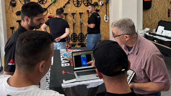
بعد الانتهاء من المسح، يوضح مارك كيفية نقل بيانات المسح من جهاز Rover C4 إلى الحاسوب المحمول لاسلكيًا. عملية النقل بسيطة، حيث يتصل الجهاز تلقائيًا بالحاسوب لاستيراد البيانات بسهولة. يشرح مارك كيفية التأكد من اختيار البنك الصحيح للذاكرة وعدد النبضات لضمان نتائج دقيقة. ثم يفتح بيانات المسح في برنامج Visualizer 3D Studio (V3DS)، وهو البرنامج المستخدم لتحليل وتفسير نتائج المسح. تكشف الصورة ثلاثية الأبعاد عن إشارة واضحة وقوية تشير إلى وجود جسم حديدي مغناطيسي — وهو ما كان متوقعًا، مما يؤكد موقع الأنبوب المدفون.
استخدام خاصية "تراكب حقل المسح" في V3DS لتحديد الموقع بدقة
واحدة من أبرز نقاط هذا الفيديو هي عرض مارك لخاصية "تراكب حقل المسح" في برنامج V3DS. تسمح هذه الخاصية للمستخدمين بوضع صورة لحقل الاختبار فوق المسح ثلاثي الأبعاد، مما يوفر رؤية أكثر تفصيلاً للطبقات تحت السطح ويساعد في التحقق من دقة المسح. يشرح مارك خطوة بخطوة كيفية محاذاة الصورة مع بيانات المسح لتحديد الموقع والعمق الدقيقين للهدف.
يوفر هذا الفيديو رؤى عملية حول استخدام جهاز OKM Rover C4 لإجراء مسح أرضي فعال. باتباع دليل مارك خطوة بخطوة، ستكتسب فهمًا أعمق لكيفية إعداد الجهاز، وإجراء المسح، وتحليل البيانات، وتفسيرها، مما يضمن نجاح مسوحاتك الخاصة.


